Nishapur (Neyshābūr)
 |
As of 2016, its central city population was estimated to be 264,180 and its county's population was estimated to be 448,125 making it the third most-populous city in the eastern provinces of Iran after Mashhad and Zahedan. Nearby are turquoise mines that have supplied the world with turquoise of the finest and the highest quality for at least two millennia.
The city was founded in the 3rd century by Shapur I as a capital city of Sasanian satrapy known as Abarshahr or Nishapur. Nishapur later became the capital of Tahirid dynasty and was reformed by Abdullah Tahir in 830, and was later selected as the capital of Seljuk dynasty by Tughril in 1037. From the Abbasid era to the Mongol invasion of Khwarezmia and Eastern Iran, the city evolved into a significant cultural, commercial, and intellectual center within the Islamic world. Nishapur, along with Merv, Herat and Balkh, was one of the four great cities of Greater Khorasan and one of the greatest cities of the Old World in the Islamic Golden Age with strategic importance, a seat of governmental power in the eastern section of caliphates, a dwelling place for diverse ethnic and religious groups and a trading stop on commercial routes from Transoxiana, China, Iraq and Egypt.
Nishapur reached the height of its prosperity under the Samanids in the 10th century but was destroyed and most of its population was slaughtered by the Mongols in 1221. This massacre, combined with subsequent earthquakes and other invasions, is believed to have destroyed the city several times. Unlike its near neighbor Merv, Nishapur managed to recover from these cataclysmic events, and survive until the present day as an active modern city and county in tourism, agriculture, health care, industrial production and commerce in Razavi Khorasan Province of Iran; however, many of its older and historical archeological remains are left to be uncovered.
The modern city of Nishapur is composed of three main administrative areas/districts (Persian: منطقه های شهر نیشابور) and is surrounded by many villages which are joining in to the urban area and structure of the city. The Area/district 1 of the city comprises the newer urban developments (initiated mostly in the 1980s and the 1990s) made to the north of the Road 44 and is home to the most of the main higher educational institutions of Nishapur such as the University of Neyshabur and the IAUN. The Area/district 2 of the city comprises the downtown of the city and the older and more historic urban structures situated on the south of the Road 44. It is home to some of the main tourists attractions of the city such as the National Garden of Nishapur and the Khanate Mansion of Amin Islami. The Area/district 3 of the city is home to the ruins and the remains of the ancient city of Nishapur destroyed by Mongols in the Middle Ages and is located on the south and the southeast of the city. The third district of the city is a national and registered protected archeological area by law and any unauthorized archeological excavation is considered illegal. This district is also home to the burial and historical monuments (some are shown on the city infobox) of most of the renowned persons of the city throughout history such as the Mausoleum of Omar Khayyám and the Mausoleum of Attar of Nishapur. The third district is also used as one of the main touristic hotspots of the city.
Many of this city's archeological discoveries are held and shown to the public in the Metropolitan Museum of Art in New York City, the British Museum in London, the National Museum of Iran in Tehran, other international museums and the museums of the city of Nishapur. The city of Nishapur is also a member of international organizations such as the LHC and the ICCN UNESCO.
History of Nishapur has been intermingled with myths and different historical narratives. According to different mythological and historical narratives, the city was founded 7500 years ago during the reign of mythical line of primordial kings known as the Pishdadian dynasty. According to Arthur Christensen, Nishapur was founded in the year 260 A.D. Nishapur was founded by the Sasanian emperor Shapur II ((r. 309 – 379)) during the last years of his rule, as demonstrated by new archaeological findings. In the 9th century, Nishapur became the capital of the Tahirid dynasty, and by the 10th century, was under Samanid rule. The city became an important and prosperous administrative center under the Samanids. In 1037, it was conquered by the Seljuks. Despite being sacked by the Oghuz Turks in 1154, and suffering several earthquakes in the twelfth and thirteenth centuries, yet continued as an important urban center until it was destroyed again by Genghis Khan and the Mongols in 1221.
During the Sasanian dynasty and medieval ages, the Nishapur quarter (Persian: ربع نیشابور) included Khorasan Province and Ahal Province.
Map - Nishapur (Neyshābūr)
Map
Country - Iran
 |
 |
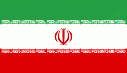
| Flag of Iran | |
The country is home to one of the world's oldest civilizations, beginning with the formation of the Elamite kingdoms in the fourth millennium BC. It was first unified by the Medes, an ancient Iranian people, in the seventh century BC, and reached its territorial height in the sixth century BC, when Cyrus the Great founded the Achaemenid Persian Empire, which became one of the largest empires in history and a superpower. The Achaemenid Empire fell to Alexander the Great in the fourth century BC and was subsequently divided into several Hellenistic states. An Iranian rebellion established the Parthian Empire in the third century BC, which was succeeded in the third century AD by the Sassanid Empire, a major world power for the next four centuries. Arab Muslims conquered the empire in the seventh century AD, which led to the Islamization of Iran. It subsequently became a major center of Islamic culture and learning, with its art, literature, philosophy, and architecture spreading across the Muslim world and beyond during the Islamic Golden Age. Over the next two centuries, a series of native Iranian Muslim dynasties emerged before the Seljuk Turks and the Mongols conquered the region. In the 15th century, the native Safavids re-established a unified Iranian state and national identity, and converted the country to Shia Islam. Under the reign of Nader Shah in the 18th century, Iran presided over the most powerful military in the world, though by the 19th century, a series of conflicts with the Russian Empire led to significant territorial losses. The early 20th century saw the Persian Constitutional Revolution. Efforts to nationalize its fossil fuel supply from Western companies led to an Anglo-American coup in 1953, which resulted in greater autocratic rule under Mohammad Reza Pahlavi and growing Western political influence. He went on to launch a far-reaching series of reforms in 1963. After the Iranian Revolution, the current Islamic Republic was established in 1979 by Ruhollah Khomeini, who became the country's first Supreme Leader.
Currency / Language
| ISO | Currency | Symbol | Significant figures |
|---|---|---|---|
| IRR | Iranian rial | ï·¼ | 2 |
| ISO | Language |
|---|---|
| KU | Kurdish language |
| FA | Persian language |


